St Peter's House, Oxford Road, Manchester
Introduction
The photograph on this page of St Peter's House, Oxford Road, Manchester by Stephen Richards as part of the Geograph project.
The Geograph project started in 2005 with the aim of publishing, organising and preserving representative images for every square kilometre of Great Britain, Ireland and the Isle of Man.

There are currently over 7.5m images from over 14,400 individuals and you can help contribute to the project by visiting https://www.geograph.org.uk
St Peter's House, Oxford Road, Manchester
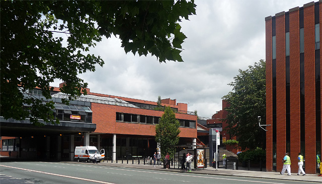
Image: © Stephen Richards Taken: 25 Jul 2011
Conceived as part of Wilson & Womersley's extensive 1970-72 Precinct Centre development, which runs west (Image]), but executed by Cruickshank & Seward. The walkway across Oxford Road (left) is the only one remaining. It comes to an abrupt and cursory end since the demolition of the Maths Tower. St Peter's House "provides chaplaincy to all the universities in Manchester". On the far right is a bit of the Kilburn Building (Image]).
Images are licensed for reuse under creativecommons.org/licenses/by-sa/2.0
Image Location
Latitude
53.467887
Longitude
-2.234805