Blaydon Burn
Introduction
The photograph on this page of Blaydon Burn by Andrew Curtis as part of the Geograph project.
The Geograph project started in 2005 with the aim of publishing, organising and preserving representative images for every square kilometre of Great Britain, Ireland and the Isle of Man.

There are currently over 7.5m images from over 14,400 individuals and you can help contribute to the project by visiting https://www.geograph.org.uk
Blaydon Burn
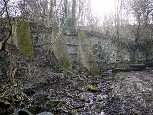
Image: © Andrew Curtis Taken: 24 Feb 2012
The east bank of Blaydon Burn, downstream from the site Massey’s Forge, is reinforced by a high stone retaining wall, strengthened at a later time by concrete buttresses. The large sandstone blocks extending from the right are thought to have been part of a former weir or sluice. Old maps show a mill race downstream for one of the burn's C18th watermills, known as Rennison’s or Pickering’s Mill, all remains of which disappeared under Cowen's Low Yard around 1830.
Images are licensed for reuse under creativecommons.org/licenses/by-sa/2.0
Image Location
Latitude
54.965181
Longitude
-1.722581