Bridges over the lower Blaydon Burn
Introduction
The photograph on this page of Bridges over the lower Blaydon Burn by Andrew Curtis as part of the Geograph project.
The Geograph project started in 2005 with the aim of publishing, organising and preserving representative images for every square kilometre of Great Britain, Ireland and the Isle of Man.

There are currently over 7.5m images from over 14,400 individuals and you can help contribute to the project by visiting https://www.geograph.org.uk
Bridges over the lower Blaydon Burn
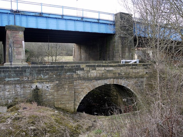
Image: © Andrew Curtis Taken: 24 Feb 2012
The old road bridge in the foreground was built for the Hexham Turnpike Trust in 1778. The large road bridge behind was added in 1936. http://list.english-heritage.org.uk/resultsingle.aspx?uid=1380569 From this point to its outlet into the River Tyne, the Blaydon Burn flows in a culvert below the track and railway line.
Images are licensed for reuse under creativecommons.org/licenses/by-sa/2.0
Image Location
Latitude
54.966343
Longitude
-1.719605