High Street, Winkleigh
Introduction
The photograph on this page of High Street, Winkleigh by Derek Harper as part of the Geograph project.
The Geograph project started in 2005 with the aim of publishing, organising and preserving representative images for every square kilometre of Great Britain, Ireland and the Isle of Man.

There are currently over 7.5m images from over 14,400 individuals and you can help contribute to the project by visiting https://www.geograph.org.uk
High Street, Winkleigh
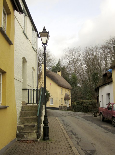
Image: © Derek Harper Taken: 20 Feb 2012
On the left, stone steps climb to the listed Brick Cottage http://www.britishlistedbuildings.co.uk/en-90969-brick-cottage-winkleigh . Up the hill is Castle House http://www.britishlistedbuildings.co.uk/en-90968-castle-house-winkleigh .
Images are licensed for reuse under creativecommons.org/licenses/by-sa/2.0
Image Location


Leaflet Map data © OpenStreetMap
Latitude
50.856921
Longitude
-3.944126