
Former Burradon and Holywell Waggonway
Introduction
The photograph on this page of Former Burradon and Holywell Waggonway by Oliver Dixon as part of the Geograph project.
The Geograph project started in 2005 with the aim of publishing, organising and preserving representative images for every square kilometre of Great Britain, Ireland and the Isle of Man.

There are currently over 7.5m images from over 14,400 individuals and you can help contribute to the project by visiting https://www.geograph.org.uk
Former Burradon and Holywell Waggonway
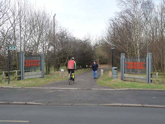
Image: © Oliver Dixon Taken: 23 Feb 2012
The Burradon and Holywell Waggonway was one of many http://www.tynelives.org.uk/stephenson/wagmap2.htm linking former coalmines in North Tyneside with the coal staithes on the Tyne. This view is taken near the western end of the waggonway where it crosses Great Lime Road near High Weetslade. Along with many other lengths of waggonway, this section has been converted into a cycle path in recent years and forms part of National Cycle Network, Regional Route 10 (the Reivers Cycle Route) http://www.cycle-n-sleep.co.uk/rinfo/map%20reivers.htm which links Tynemouth with Whitehaven via Kielder Forest and Carlisle. Ironwork street furniture, such as these mock gates, is a common feature found on the restored paths.
Images are licensed for reuse under creativecommons.org/licenses/by-sa/2.0
Image Location

Latitude
55.044528
Longitude
-1.593863