Ruined buildings of former colliery, Blaydon Burn
Introduction
The photograph on this page of Ruined buildings of former colliery, Blaydon Burn by Andrew Curtis as part of the Geograph project.
The Geograph project started in 2005 with the aim of publishing, organising and preserving representative images for every square kilometre of Great Britain, Ireland and the Isle of Man.

There are currently over 7.5m images from over 14,400 individuals and you can help contribute to the project by visiting https://www.geograph.org.uk
Ruined buildings of former colliery, Blaydon Burn
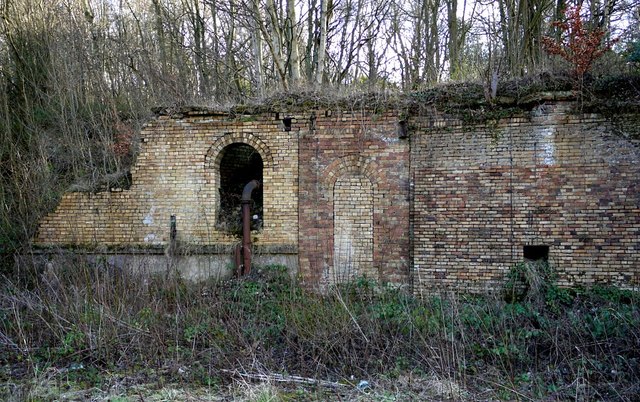
Image: © Andrew Curtis Taken: 19 Feb 2012
The west end of the Nature Reserve, where the burn meets the road, was formerly the railhead of the valley line Image The ruined buildings shown here lie between the upper and lower sections of the railhead. The most notable is a large section of retaining wall showing numerous phases of build and construction types. The wall includes a number of arched openings and cast-iron pipework, of unknown function, but probably associated with adjacent coal screens to the north-east. There is another photo here Image
Images are licensed for reuse under creativecommons.org/licenses/by-sa/2.0
Image Location
Latitude
54.954977
Longitude
-1.740608