Retaining wall and ruined building, Blaydon Burn
Introduction
The photograph on this page of Retaining wall and ruined building, Blaydon Burn by Andrew Curtis as part of the Geograph project.
The Geograph project started in 2005 with the aim of publishing, organising and preserving representative images for every square kilometre of Great Britain, Ireland and the Isle of Man.

There are currently over 7.5m images from over 14,400 individuals and you can help contribute to the project by visiting https://www.geograph.org.uk
Retaining wall and ruined building, Blaydon Burn
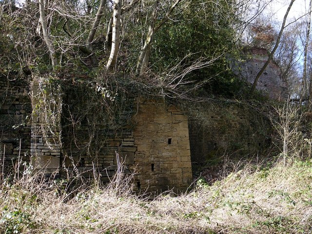
Image: © Andrew Curtis Taken: 19 Feb 2012
A retaining wall that runs for about 250m defining the north side of the central waggonway, It has been built and repaired in numerous phases probably associated with the changing industries of the valley bottom. The substantial ruined brick building to the right is thought to be contemporary with the wall and may have been built for Priestman Colliery between 1900 and 1914. It may have been used for screening coal.
Images are licensed for reuse under creativecommons.org/licenses/by-sa/2.0
Image Location
Latitude
54.95578
Longitude
-1.738261