Upcott Lane
Introduction
The photograph on this page of Upcott Lane by Derek Harper as part of the Geograph project.
The Geograph project started in 2005 with the aim of publishing, organising and preserving representative images for every square kilometre of Great Britain, Ireland and the Isle of Man.

There are currently over 7.5m images from over 14,400 individuals and you can help contribute to the project by visiting https://www.geograph.org.uk
Upcott Lane
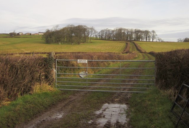
Image: © Derek Harper Taken: 20 Feb 2012
Carrying Broadwoodkelly Footpath 9 from Barntown Lane, hence the warning about dogs on leads. The end of the enclosed section of the lane can be seen just before it reaches the right-hand group of trees; at this point the public footpath turns right across a field. The nearer clump of trees is Yennepark Copse, and the farm on the left is Upcott, in Image
Images are licensed for reuse under creativecommons.org/licenses/by-sa/2.0
Image Location


Leaflet Map data © OpenStreetMap
Latitude
50.840783
Longitude
-3.96263