Gloucester Road, Redhill
Introduction
The photograph on this page of Gloucester Road, Redhill by Stefan Czapski as part of the Geograph project.
The Geograph project started in 2005 with the aim of publishing, organising and preserving representative images for every square kilometre of Great Britain, Ireland and the Isle of Man.

There are currently over 7.5m images from over 14,400 individuals and you can help contribute to the project by visiting https://www.geograph.org.uk
Gloucester Road, Redhill
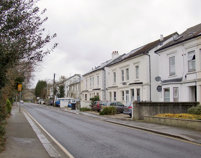
Image: © Stefan Czapski Taken: 18 Feb 2012
Substantial mid-19th century semis line this residential street close to the town centre. On architectural grounds I'd date these houses somewhere between 1830 and 1850. The railways reached Redhill in 1841 (the Brighton line, LB&SCR) and 1842 (the South Eastern) - so it seems likely that Gloucester Road was part of an early phase in the town's expansion. It's worth mentioning that the first Redhill station was (at first) known as 'Reigate' - railways passing through humble districts often chose to give their station the name of a 'posher' neighbouring community. A well-known example is Clapham Junction, which is in Battersea.
Images are licensed for reuse under creativecommons.org/licenses/by-sa/2.0
Image Location
Latitude
51.242783
Longitude
-0.170067