Clavering: North windmill
Introduction
The photograph on this page of Clavering: North windmill by Nigel Cox as part of the Geograph project.
The Geograph project started in 2005 with the aim of publishing, organising and preserving representative images for every square kilometre of Great Britain, Ireland and the Isle of Man.

There are currently over 7.5m images from over 14,400 individuals and you can help contribute to the project by visiting https://www.geograph.org.uk
Clavering: North windmill
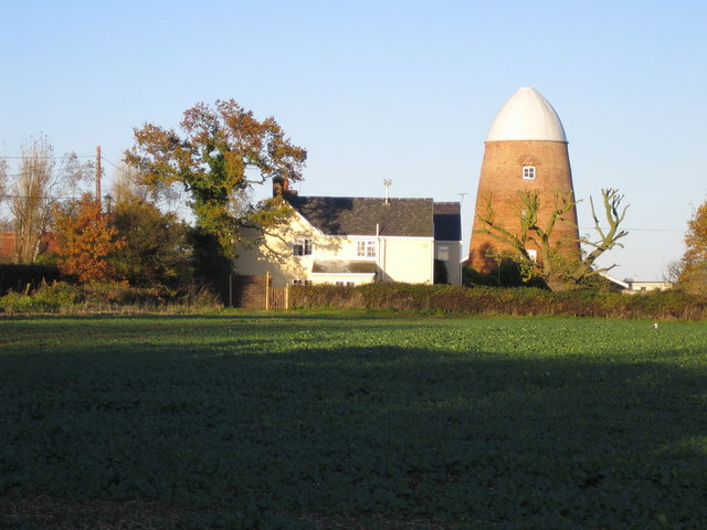
Image: © Nigel Cox Taken: 18 Nov 2006
This is the larger of the two Clavering windmills and was built in 1811 for milling corn. The relative locations of the two mills can be seen in Image It is now a private residence.
Images are licensed for reuse under creativecommons.org/licenses/by-sa/2.0
Image Location
Latitude
51.974337
Longitude
0.132879