View from Silver Hill
Introduction
The photograph on this page of View from Silver Hill by Penny Mayes as part of the Geograph project.
The Geograph project started in 2005 with the aim of publishing, organising and preserving representative images for every square kilometre of Great Britain, Ireland and the Isle of Man.

There are currently over 7.5m images from over 14,400 individuals and you can help contribute to the project by visiting https://www.geograph.org.uk
View from Silver Hill
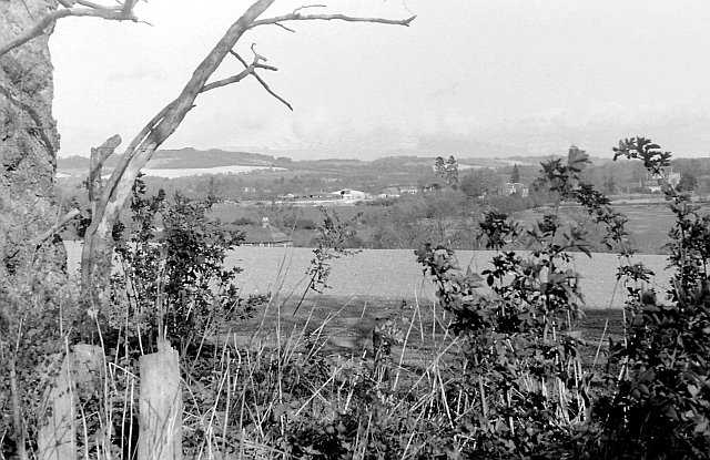
Image: © Penny Mayes Taken: Unknown
Taken in the days before the high speed channel tunnel rail link and the M20 extension. The house on the left in the mid-ground is Musketstone, an isolated property on Musket Lane, subsequently removed to make way for the railway. Beyond are the barns of Eyhorne Farm. The two redwoods right of centre are in the grounds of Eyhorne Cottage (a large Georgian house visible to the right of them). The M20 came to an end just out of sight in a cutting to the right. At this time, in the mid 1970s, it only went the 13 miles to Wrotham but its four junctions made it a very useful Maidstone bypass.
Images are licensed for reuse under creativecommons.org/licenses/by-sa/2.0
Image Location
Latitude
51.262899
Longitude
0.613096