Grade II listed Grosmont Town Hall
Introduction
The photograph on this page of Grade II listed Grosmont Town Hall by Jaggery as part of the Geograph project.
The Geograph project started in 2005 with the aim of publishing, organising and preserving representative images for every square kilometre of Great Britain, Ireland and the Isle of Man.

There are currently over 7.5m images from over 14,400 individuals and you can help contribute to the project by visiting https://www.geograph.org.uk
Grade II listed Grosmont Town Hall
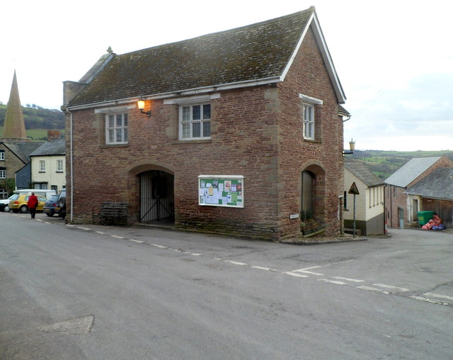
Image: © Jaggery Taken: 19 Feb 2012
It may seem incongruous that the village of Grosmont, population about 300, has a town hall. The original town hall was a timber structure built in the Middle Ages when Grosmont was reputed to have been for a time the third-largest settlement in South Wales. The present town hall dates from the 1830s, at a time when Grosmont still had a mayor. It is now used by Grosmont Community Council which covers a large area of thinly-populated North East Monmouthshire. There are four council wards, Grosmont, Llangua, Llangattock Lingoed and Llanvetherine, with a total population of c600. The town hall was Grade II listed in March 1981.
Images are licensed for reuse under creativecommons.org/licenses/by-sa/2.0
Image Location
Latitude
51.914025
Longitude
-2.867896