County boundary stone
Introduction
The photograph on this page of County boundary stone by Neil Owen as part of the Geograph project.
The Geograph project started in 2005 with the aim of publishing, organising and preserving representative images for every square kilometre of Great Britain, Ireland and the Isle of Man.

There are currently over 7.5m images from over 14,400 individuals and you can help contribute to the project by visiting https://www.geograph.org.uk
County boundary stone
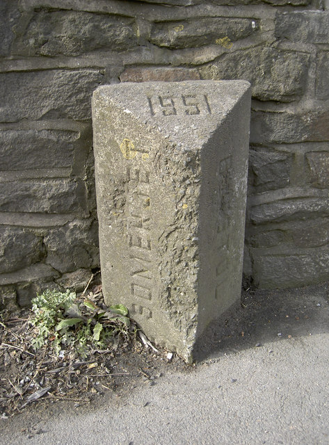
Image: © Neil Owen Taken: 14 Feb 2012
It used to be the divisor between Bristol and Somerset, but now it marks the boundary of Bristol and BaNES. How times (and politics) have changed since 1951. See Image] for a more modern approach to signage.
Images are licensed for reuse under creativecommons.org/licenses/by-sa/2.0
Image Location
Latitude
51.411126
Longitude
-2.558978