
Newcastle skyline from Windmill Hills
Introduction
The photograph on this page of Newcastle skyline from Windmill Hills by Andrew Curtis as part of the Geograph project.
The Geograph project started in 2005 with the aim of publishing, organising and preserving representative images for every square kilometre of Great Britain, Ireland and the Isle of Man.

There are currently over 7.5m images from over 14,400 individuals and you can help contribute to the project by visiting https://www.geograph.org.uk
Newcastle skyline from Windmill Hills
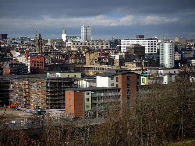
Image: © Andrew Curtis Taken: 16 Feb 2012
Looking out over Wellbrook House and Gateshead's new apartments. Grey's Monument is visible among the roofs on the left; Cale Cross House distinguished by its green and white stripes marks the right. The crowned spire of St Nicholas Cathedral, the Black Gate, Castle Keep and the line of the High Level Bridge can be seen in the town - a scatter of the new and the old. The green domed roof of the Civic Centre Image is in the distance, just left of centre, with the tower block of Bewick Court Image on its right. Directly below them, the Pearl Assurance Image and Carliol House Image buildings are prominent. 55 Degrees North Image is the large white block to their right.
Images are licensed for reuse under creativecommons.org/licenses/by-sa/2.0
Image Location

Latitude
54.962808
Longitude
-1.610617