Coastal housing and railway line, Dawlish
Introduction
The photograph on this page of Coastal housing and railway line, Dawlish by David Martin as part of the Geograph project.
The Geograph project started in 2005 with the aim of publishing, organising and preserving representative images for every square kilometre of Great Britain, Ireland and the Isle of Man.

There are currently over 7.5m images from over 14,400 individuals and you can help contribute to the project by visiting https://www.geograph.org.uk
Coastal housing and railway line, Dawlish
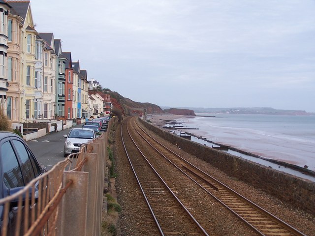
Image: © David Martin Taken: 14 Feb 2012
The sea wall, railway line and road in the centre of this scene collapsed during a huge storm on 5 February 2014, endangering some of the houses and closing the rail link to the west.
Images are licensed for reuse under creativecommons.org/licenses/by-sa/2.0
Image Location
Latitude
50.584576
Longitude
-3.459091