Plate on brickwork, Railway Hill, Barham
Introduction
The photograph on this page of Plate on brickwork, Railway Hill, Barham by John Baker as part of the Geograph project.
The Geograph project started in 2005 with the aim of publishing, organising and preserving representative images for every square kilometre of Great Britain, Ireland and the Isle of Man.

There are currently over 7.5m images from over 14,400 individuals and you can help contribute to the project by visiting https://www.geograph.org.uk
Plate on brickwork, Railway Hill, Barham
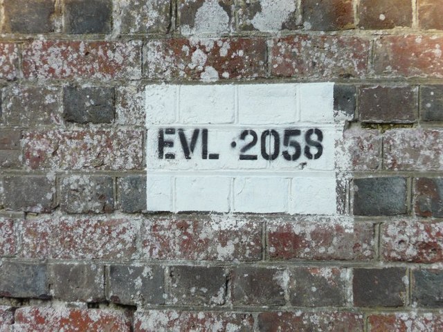
Image: © John Baker Taken: 11 Feb 2012
EVL stands for Elham Valley Line and refers to the railway that ran along the valley from Cheriton to Canterbury until closure in 1947. A rail bridge crossed the road at this point of which only a truncated abutment of its northeastern side remains.
Images are licensed for reuse under creativecommons.org/licenses/by-sa/2.0
Image Location
Latitude
51.201891
Longitude
1.154112