Dumbah Lane/Heybridge Lane/Manchester Road junction
Introduction
The photograph on this page of Dumbah Lane/Heybridge Lane/Manchester Road junction by Peter Turner as part of the Geograph project.
The Geograph project started in 2005 with the aim of publishing, organising and preserving representative images for every square kilometre of Great Britain, Ireland and the Isle of Man.

There are currently over 7.5m images from over 14,400 individuals and you can help contribute to the project by visiting https://www.geograph.org.uk
Dumbah Lane/Heybridge Lane/Manchester Road junction
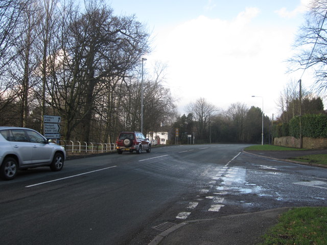
Image: © Peter Turner Taken: 26 Jan 2012
Dumbah Lane comes in from the right foreground. The major road is the A538 Manchester Road from the left. The A538 becomes Heybridge Lane as it bears left before the white house visible left of centre. The ongoing 'major' road, once the A523 to Stockport, thereafter becomes the B5091 and is named London Road.
Images are licensed for reuse under creativecommons.org/licenses/by-sa/2.0
Image Location
Latitude
53.286746
Longitude
-2.13106