Stone Fence at Pant Du
Introduction
The photograph on this page of Stone Fence at Pant Du by John S Turner as part of the Geograph project.
The Geograph project started in 2005 with the aim of publishing, organising and preserving representative images for every square kilometre of Great Britain, Ireland and the Isle of Man.

There are currently over 7.5m images from over 14,400 individuals and you can help contribute to the project by visiting https://www.geograph.org.uk
Stone Fence at Pant Du
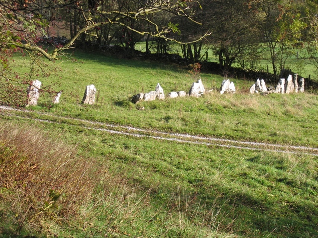
Image: © John S Turner Taken: 13 Nov 2006
This line of stones appears to have been set up as a fence rather than a wall. The area is indicated as Pant Du on the 25,000 O.S. map. - Pant is a 'hollow or depression', and Du is 'black', so 'Black Hollow' would seem to fit with the extensive lead mining that was carried out in these hills over many years. The photo is taken from the Clwydian Way.
Images are licensed for reuse under creativecommons.org/licenses/by-sa/2.0
Image Location


Leaflet Map data © OpenStreetMap
Latitude
53.126715
Longitude
-3.18954