The Balancing Barn
Introduction
The photograph on this page of The Balancing Barn by John Goldsmith as part of the Geograph project.
The Geograph project started in 2005 with the aim of publishing, organising and preserving representative images for every square kilometre of Great Britain, Ireland and the Isle of Man.

There are currently over 7.5m images from over 14,400 individuals and you can help contribute to the project by visiting https://www.geograph.org.uk
The Balancing Barn
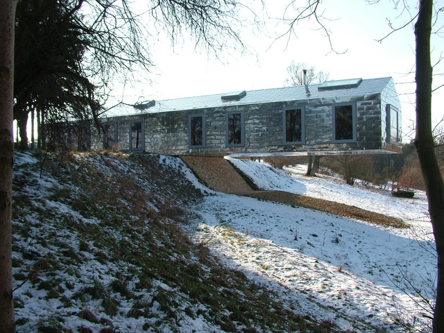
Image: © John Goldsmith Taken: 11 Feb 2012
The Balancing Barn is opposite the church at Thorington. This holiday home could not have a more boring shape but cladding it with shiny metal panels and making half of it overhang a cliff certainly gave it a Wow factor. The structure is based on a lot of structural steelwork. From the map it appears it replaced a more conventional building. The end window gives a view over a pond, and a glimpse through trees of a nature conservation area. However this shot was taken from a public footpath so privacy is limited. The steep slope is part of some unusual topography, as a flood plain is bounded on each side by slopes like this - at first I assumed these were created by the passage of a glacier but the southern one does a right angled turn at one point slightly east of here. Far more details, including how to book a holiday there, see http://www.living-architecture.co.uk/the-houses/balancing-barn/overview/
Images are licensed for reuse under creativecommons.org/licenses/by-sa/2.0
Image Location
Latitude
52.313492
Longitude
1.552811