Pillbox, north of Ouston airfield
Introduction
The photograph on this page of Pillbox, north of Ouston airfield by Andrew Curtis as part of the Geograph project.
The Geograph project started in 2005 with the aim of publishing, organising and preserving representative images for every square kilometre of Great Britain, Ireland and the Isle of Man.

There are currently over 7.5m images from over 14,400 individuals and you can help contribute to the project by visiting https://www.geograph.org.uk
Pillbox, north of Ouston airfield
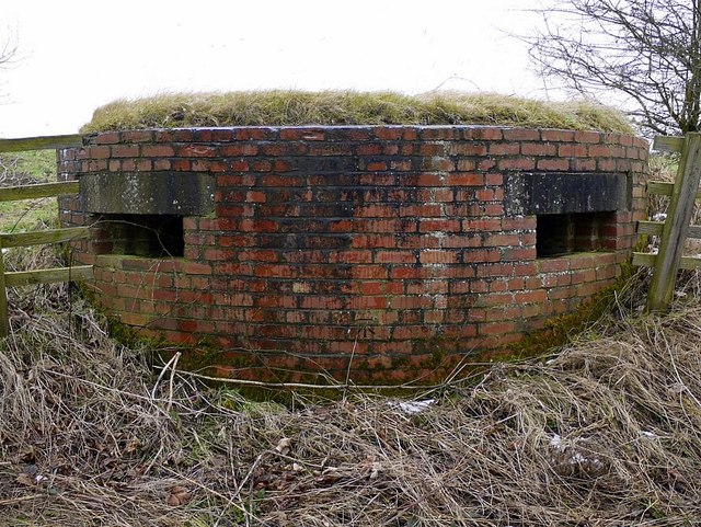
Image: © Andrew Curtis Taken: 10 Feb 2012
Unusual in Northumberland in being brick-built, and of a keyhole shape. It covered the minor road from Ouston to Stob Hill on the north side of the airfield. The same pillbox is shown here Image and here Image http://www.keystothepast.info/article/10339/Site-Details?PRN=N20032
Images are licensed for reuse under creativecommons.org/licenses/by-sa/2.0
Image Location


Leaflet Map data © OpenStreetMap
Latitude
55.028785
Longitude
-1.874979