Demolition work in Galashiels
Introduction
The photograph on this page of Demolition work in Galashiels by Walter Baxter as part of the Geograph project.
The Geograph project started in 2005 with the aim of publishing, organising and preserving representative images for every square kilometre of Great Britain, Ireland and the Isle of Man.

There are currently over 7.5m images from over 14,400 individuals and you can help contribute to the project by visiting https://www.geograph.org.uk
Demolition work in Galashiels
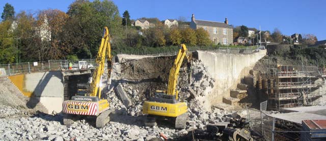
Image: © Walter Baxter Taken: 9 Nov 2006
This photograph, taken on 09/11/06 from the first floor of Galashiels Health Centre, shows demolition work continuing on the East abutment after the steel framed Station Brae Bridge had been dismantled. The removal of the bridge was delayed because of complications in diverting B.T. cables within the structure. The scaffolding on the right is part of the construction work for the South end of the Waverley rail link bridge.
Images are licensed for reuse under creativecommons.org/licenses/by-sa/2.0
Image Location
Latitude
55.616406
Longitude
-2.801907