
St John the Evangelist, Cinderford
Introduction
The photograph on this page of St John the Evangelist, Cinderford by Des Blenkinsopp as part of the Geograph project.
The Geograph project started in 2005 with the aim of publishing, organising and preserving representative images for every square kilometre of Great Britain, Ireland and the Isle of Man.

There are currently over 7.5m images from over 14,400 individuals and you can help contribute to the project by visiting https://www.geograph.org.uk
St John the Evangelist, Cinderford
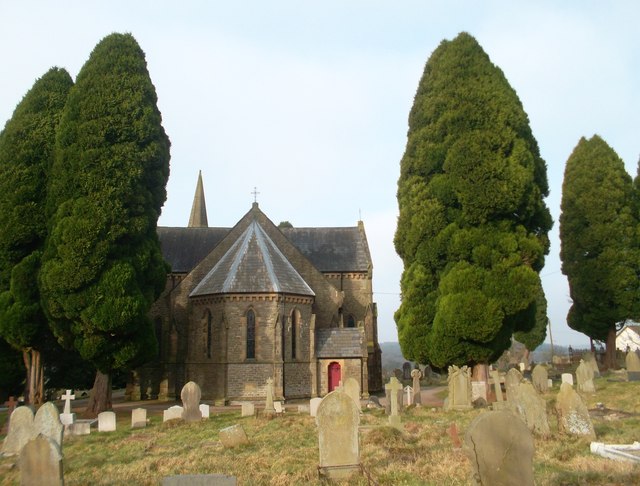
Image: © Des Blenkinsopp Taken: 9 Feb 2012
Parish church, dating from 1844. It cost £2694 11 shillings 4 pence to build. A very full history written by a previous vicar is on the parish site http://www.stjohnscinderford.org/page8.html. This details everything from the despair of the Victorian clergy over "the lawlessness and laxity of morals" of the locals and the efforts of local worthies to get land for a church, right up to the replacement of the chancel carpets in 2005.
Images are licensed for reuse under creativecommons.org/licenses/by-sa/2.0
Image Location

Latitude
51.812475
Longitude
-2.505328