Level crossing, Artillery Road, Coleraine
Introduction
The photograph on this page of Level crossing, Artillery Road, Coleraine by Albert Bridge as part of the Geograph project.
The Geograph project started in 2005 with the aim of publishing, organising and preserving representative images for every square kilometre of Great Britain, Ireland and the Isle of Man.

There are currently over 7.5m images from over 14,400 individuals and you can help contribute to the project by visiting https://www.geograph.org.uk
Level crossing, Artillery Road, Coleraine
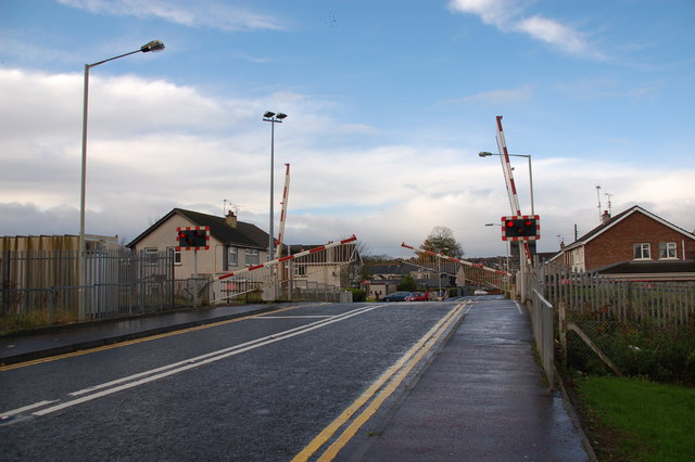
Image: © Albert Bridge Taken: 16 Nov 2006
The Artillery Road is off the Millburn Road. The level crossing is one of two on the line from Coleraine to Portrush. The crossing is an automatic full barrier one remotely monitored. It is often known by its old name of “Calf Lane”. The view is towards the Millburn Road.
Images are licensed for reuse under creativecommons.org/licenses/by-sa/2.0
Image Location
Latitude
55.141317
Longitude
-6.659982