Box Hill & Westhumble Station
Introduction
The photograph on this page of Box Hill & Westhumble Station by Stefan Czapski as part of the Geograph project.
The Geograph project started in 2005 with the aim of publishing, organising and preserving representative images for every square kilometre of Great Britain, Ireland and the Isle of Man.

There are currently over 7.5m images from over 14,400 individuals and you can help contribute to the project by visiting https://www.geograph.org.uk
Box Hill & Westhumble Station
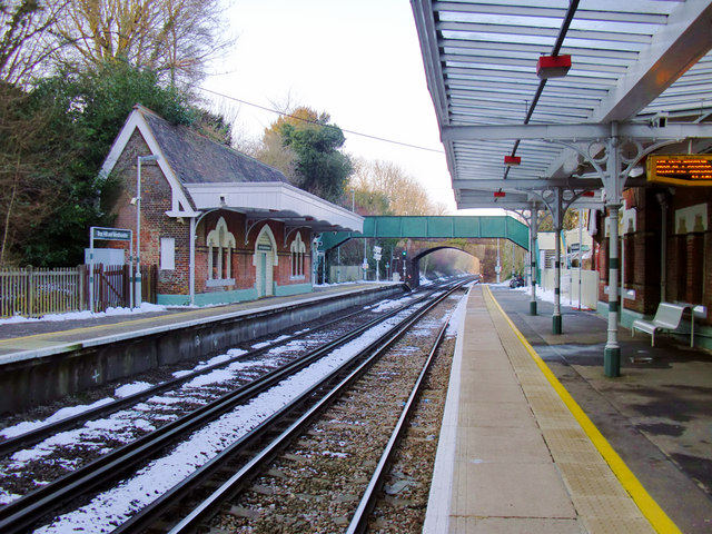
Image: © Stefan Czapski Taken: 7 Feb 2012
The Leatherhead-Dorking line passes through the village of Westhumble; Box Hill is further to the south-east. The line was built by the London, Brighton & South Coast Railway, and the station opened in 1867. According to Dendy Marshall's 'History of the Southern Railway' it has at one time or another been known as 'West Humble', 'Boxhill & Burford Bridge' (for much of its history) and 'Box Hill'. This is the view in the 'up' direction - towards Leatherhead and London. At the northern end of the station is a footbridge, and beyond that a brick-built road bridge. For a view taken from the road bridge in 1961, see Ben Brooksbank's Image
Images are licensed for reuse under creativecommons.org/licenses/by-sa/2.0
Image Location
Latitude
51.253972
Longitude
-0.328979