Former millrace, Comber
Introduction
The photograph on this page of Former millrace, Comber by Albert Bridge as part of the Geograph project.
The Geograph project started in 2005 with the aim of publishing, organising and preserving representative images for every square kilometre of Great Britain, Ireland and the Isle of Man.

There are currently over 7.5m images from over 14,400 individuals and you can help contribute to the project by visiting https://www.geograph.org.uk
Former millrace, Comber
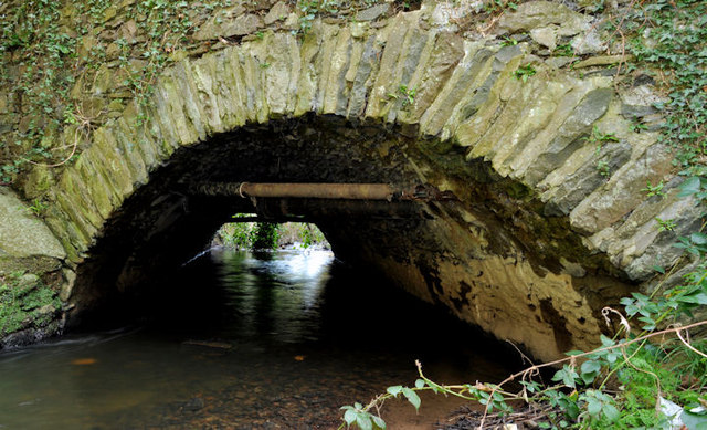
Image: © Albert Bridge Taken: 3 Feb 2012
To the best of my knowledge this is not a completely man-made millrace but a stream (the “Mill Stream”) which was diverted to power the former Andrews Mill Image In this view it is flowing under the Old Ballygowan Road. See also Image Image shows the view further upstream.
Images are licensed for reuse under creativecommons.org/licenses/by-sa/2.0
Image Location
Latitude
54.547253
Longitude
-5.752703