Bridgewater Canal, St George's Island
Introduction
The photograph on this page of Bridgewater Canal, St George's Island by David Dixon as part of the Geograph project.
The Geograph project started in 2005 with the aim of publishing, organising and preserving representative images for every square kilometre of Great Britain, Ireland and the Isle of Man.

There are currently over 7.5m images from over 14,400 individuals and you can help contribute to the project by visiting https://www.geograph.org.uk
Bridgewater Canal, St George's Island
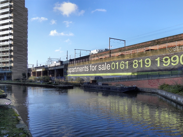
Image: © David Dixon Taken: 1 Feb 2012
A giant poster on the side of the nineteenth century railway viaduct advertises the twenty first century apartments which have replaced the decaying industrial buildings as the area has undergone regeneration. The apartment block is on a small promontory of land known as “St George’s Island” close to the Mancunian Way. The water between the apartments and the viaduct was the Hulme Locks Junction Canal which once formed an important connection between the Bridgewater Canal and the River Irwell / Manchester Ship Canal. The Hulme Locks Junction Canal was only 200 metres in length. It opened in 1938 but has fallen into a state decline today having been replaced by a new lock which was built in 1995 near to Pomona Dock Number 3. http://manchesterhistory.net/manchester/outside.html - Manchester History Net
Images are licensed for reuse under creativecommons.org/licenses/by-sa/2.0
Image Location
Latitude
53.473584
Longitude
-2.261503