Dunchurch Depot
Introduction
The photograph on this page of Dunchurch Depot by Stephen McKay as part of the Geograph project.
The Geograph project started in 2005 with the aim of publishing, organising and preserving representative images for every square kilometre of Great Britain, Ireland and the Isle of Man.

There are currently over 7.5m images from over 14,400 individuals and you can help contribute to the project by visiting https://www.geograph.org.uk
Dunchurch Depot
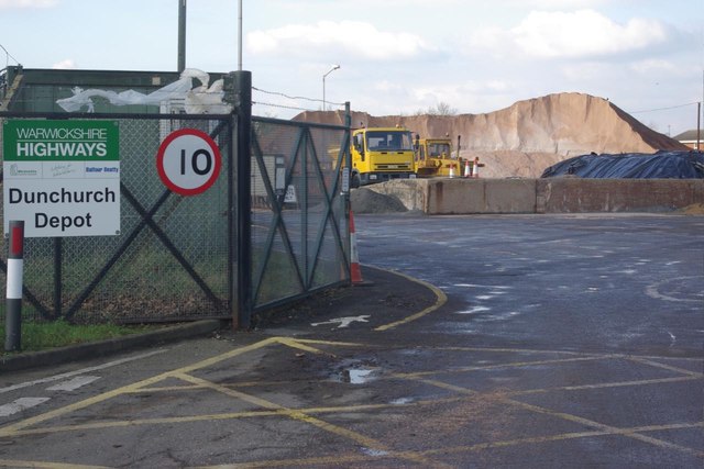
Image: © Stephen McKay Taken: 30 Jan 2012
Rock salt is piled high ready for spreading on the county's roads and, although not needed much so far this winter, if the forecasts are correct the gritters will be required for the next few nights at least. The speed restriction sign seems curiously makeshift for what is, after all, a Highways Department depot.
Images are licensed for reuse under creativecommons.org/licenses/by-sa/2.0
Image Location
Latitude
52.33533
Longitude
-1.293154