#59 and #61 Banbury Road
Introduction
The photograph on this page of #59 and #61 Banbury Road by Roger Templeman as part of the Geograph project.
The Geograph project started in 2005 with the aim of publishing, organising and preserving representative images for every square kilometre of Great Britain, Ireland and the Isle of Man.

There are currently over 7.5m images from over 14,400 individuals and you can help contribute to the project by visiting https://www.geograph.org.uk
#59 and #61 Banbury Road
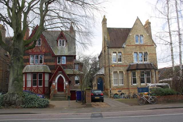
Image: © Roger Templeman Taken: 30 Jan 2012
#59 (Hertford College Annex) is on the left and #61(School of Anthropology) on the right. There was an Ordnance Survey cut mark benchmark on the road end of the party wall, levelled at 63.49m above Newlyn datum in 1970. The wall end looks to have been rebuilt.
Images are licensed for reuse under creativecommons.org/licenses/by-sa/2.0
Image Location
Latitude
51.764127
Longitude
-1.260955