Ordnance Survey benchmark on Holy Trinity Church
Introduction
The photograph on this page of Ordnance Survey benchmark on Holy Trinity Church by Shantavira as part of the Geograph project.
The Geograph project started in 2005 with the aim of publishing, organising and preserving representative images for every square kilometre of Great Britain, Ireland and the Isle of Man.

There are currently over 7.5m images from over 14,400 individuals and you can help contribute to the project by visiting https://www.geograph.org.uk
Ordnance Survey benchmark on Holy Trinity Church
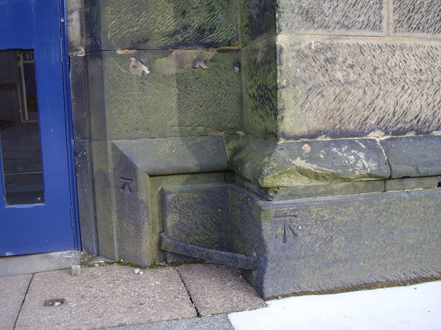
Image: © Shantavira Taken: 28 Jan 2012
Ordnance Survey benchmark on Holy Trinity Church levelled with a height of 163.1869m above sea level at Newlyn. To the left of it is a smaller unidentified mark.
Images are licensed for reuse under creativecommons.org/licenses/by-sa/2.0
Image Location
Latitude
52.494586
Longitude
-1.971529