Warrington this way
Introduction
The photograph on this page of Warrington this way by Peter Whatley as part of the Geograph project.
The Geograph project started in 2005 with the aim of publishing, organising and preserving representative images for every square kilometre of Great Britain, Ireland and the Isle of Man.

There are currently over 7.5m images from over 14,400 individuals and you can help contribute to the project by visiting https://www.geograph.org.uk
Warrington this way
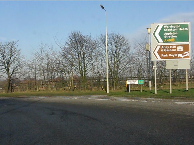
Image: © Peter Whatley Taken: 17 Jan 2012
Signs at the northbound A49 exit at M56, junction 10. The street sign is interesting on two grounds. First it incorporates the A49 route number in addition to the name. Second, Tarporley Road must be one of the longest continuously used road names in the UK. The A49 is Tarporley Road from Whitchurch, through Tarporley and on to Stretton, south of Warrington, roughly 33 miles.
Images are licensed for reuse under creativecommons.org/licenses/by-sa/2.0
Image Location
Latitude
53.335602
Longitude
-2.572265