Wind turbine, Mallusk, Newtownabbey (1)
Introduction
The photograph on this page of Wind turbine, Mallusk, Newtownabbey (1) by Albert Bridge as part of the Geograph project.
The Geograph project started in 2005 with the aim of publishing, organising and preserving representative images for every square kilometre of Great Britain, Ireland and the Isle of Man.

There are currently over 7.5m images from over 14,400 individuals and you can help contribute to the project by visiting https://www.geograph.org.uk
Wind turbine, Mallusk, Newtownabbey (1)
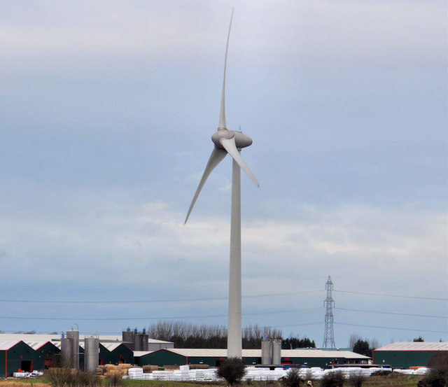
Image: © Albert Bridge Taken: 25 Jan 2012
A wind turbine, commissioned in 2011, at commercial premises at Mallusk. The owner’s website includes the following information “Preparatory site work began in September 2010 towards a scheduled completed commissioning date of early June 2011 . . . . The Enercon E-70 wind turbine has a blade span of 71 metres and when the blade is fully extended the structure measures 99.5 metres from the ground to the blade tip. With an output of 2.3mwatt the wind turbine will contribute 20% of [the owner’s] energy needs. Having supplied and installed the wind turbine Enercon have also been contracted for its ongoing maintenance”. Image shows a close view of the blades. This photograph appears as a matter of neutral record only and should not be interpreted as expressing any opinion, for or against, the turbine.
Images are licensed for reuse under creativecommons.org/licenses/by-sa/2.0
Image Location
Latitude
54.686437
Longitude
-6.015022