Whittington Road
Introduction
The photograph on this page of Whittington Road by Martin Addison as part of the Geograph project.
The Geograph project started in 2005 with the aim of publishing, organising and preserving representative images for every square kilometre of Great Britain, Ireland and the Isle of Man.

There are currently over 7.5m images from over 14,400 individuals and you can help contribute to the project by visiting https://www.geograph.org.uk
Whittington Road
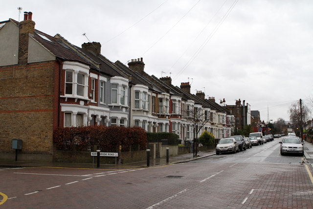
Image: © Martin Addison Taken: 20 Jan 2012
Seen from the junction with Northbrook Road. The terraced housing dates to circa 1880, concurrent with the building of the nearby railway station. The Alexandra Palace antenna is visible on the distant horizon.
Images are licensed for reuse under creativecommons.org/licenses/by-sa/2.0
Image Location
Latitude
51.606991
Longitude
-0.119355