St Barbara's Church, Deepcut
Introduction
The photograph on this page of St Barbara's Church, Deepcut by Len Williams as part of the Geograph project.
The Geograph project started in 2005 with the aim of publishing, organising and preserving representative images for every square kilometre of Great Britain, Ireland and the Isle of Man.

There are currently over 7.5m images from over 14,400 individuals and you can help contribute to the project by visiting https://www.geograph.org.uk
St Barbara's Church, Deepcut
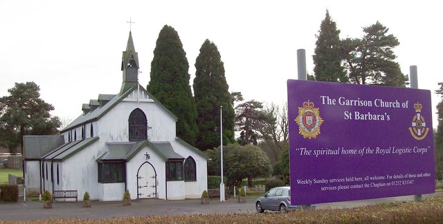
Image: © Len Williams Taken: 22 Jan 2012
St Barbara's Church is the garrison church for the Royal Logistic Corps (RLC). The associated Blackdown and Deepcut barracks are scheduled for closure, however the fate of the church has not been decided. Of particular concern are the stained glass windows, which only have relevance to the Army. For a view of the altar refer to picture Image
Images are licensed for reuse under creativecommons.org/licenses/by-sa/2.0
Image Location
Latitude
51.306215
Longitude
-0.704967