Trinity Presbyterian church, Ballygowan
Introduction
The photograph on this page of Trinity Presbyterian church, Ballygowan by Albert Bridge as part of the Geograph project.
The Geograph project started in 2005 with the aim of publishing, organising and preserving representative images for every square kilometre of Great Britain, Ireland and the Isle of Man.

There are currently over 7.5m images from over 14,400 individuals and you can help contribute to the project by visiting https://www.geograph.org.uk
Trinity Presbyterian church, Ballygowan
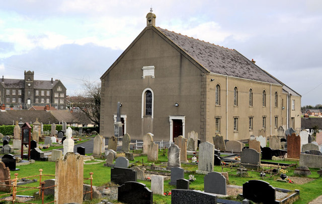
Image: © Albert Bridge Taken: 21 Jan 2012
Presbyterian church, at the Church Hill, with a datestone reading “1838”’. Listed as HB24/16/001 where the description includes “Large, relatively plain, two storey gabled Presbyterian church of 1838”. Architect not recorded. There is a later extension at the back. Last seen in December 2007 Image The former orphanage Image, on the Comber Road, is at middle left.
Images are licensed for reuse under creativecommons.org/licenses/by-sa/2.0
Image Location
Latitude
54.501303
Longitude
-5.789809