Former orphanage, Ballygowan (3)
Introduction
The photograph on this page of Former orphanage, Ballygowan (3) by Albert Bridge as part of the Geograph project.
The Geograph project started in 2005 with the aim of publishing, organising and preserving representative images for every square kilometre of Great Britain, Ireland and the Isle of Man.

There are currently over 7.5m images from over 14,400 individuals and you can help contribute to the project by visiting https://www.geograph.org.uk
Former orphanage, Ballygowan (3)
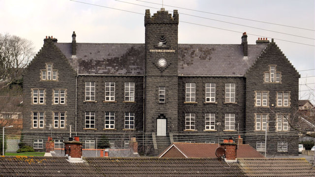
Image: © Albert Bridge Taken: 21 Jan 2012
In a village without a church spire, the former orphanage is the dominant feature. This view, across the rooftops, is from the Church Hill.
Images are licensed for reuse under creativecommons.org/licenses/by-sa/2.0
Image Location
Latitude
54.503011
Longitude
-5.789871