Hurricane Way, Hawkinge
Introduction
The photograph on this page of Hurricane Way, Hawkinge by John Baker as part of the Geograph project.
The Geograph project started in 2005 with the aim of publishing, organising and preserving representative images for every square kilometre of Great Britain, Ireland and the Isle of Man.

There are currently over 7.5m images from over 14,400 individuals and you can help contribute to the project by visiting https://www.geograph.org.uk
Hurricane Way, Hawkinge
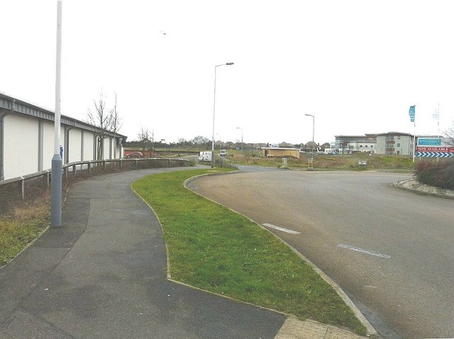
Image: © John Baker Taken: 20 Jan 2012
Looking along the wall of the Lidl supermarket towards the land that is being built on in Defiant Close. Planning permission has been approved, with conditions, by Folkestone and Hythe District Council under application number Y10/0739/SH for "mixed use development comprising the erection of 4, three storey blocks providing 8 ground floor commercial units and 48, 2 bedroom apartments above together with associated access, parking landscaping and open space". The pale-coloured, rectangular building in the centre of the picture has been constructed of wood and the large building on the right is Image
Images are licensed for reuse under creativecommons.org/licenses/by-sa/2.0
Image Location
Latitude
51.111421
Longitude
1.16009