
Minions Mound
Introduction
The photograph on this page of Minions Mound by Eric Foster as part of the Geograph project.
The Geograph project started in 2005 with the aim of publishing, organising and preserving representative images for every square kilometre of Great Britain, Ireland and the Isle of Man.

There are currently over 7.5m images from over 14,400 individuals and you can help contribute to the project by visiting https://www.geograph.org.uk
Minions Mound
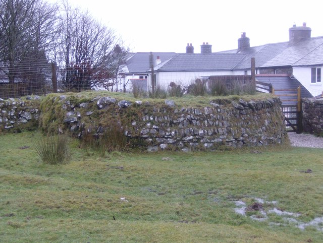
Image: © Eric Foster Taken: 19 Jan 2012
The remains of a Bronze age cairn, that gave its name to the village of Minions, formerly called Cheeswring Railway. During the construction of the garden wall for the adjacent cottages the cairn was cut in half, leaving a 'D' shaped structure. I doubt that few, or indeed any of the thousands of visitors to the Hurlers stone circles nearby who use the car park that the cairn is next to, have any idea just what this structure actually is.
Images are licensed for reuse under creativecommons.org/licenses/by-sa/2.0
Image Location

Latitude
50.514028
Longitude
-4.45587