Row of buildings, High Street, Elham
Introduction
The photograph on this page of Row of buildings, High Street, Elham by John Baker as part of the Geograph project.
The Geograph project started in 2005 with the aim of publishing, organising and preserving representative images for every square kilometre of Great Britain, Ireland and the Isle of Man.

There are currently over 7.5m images from over 14,400 individuals and you can help contribute to the project by visiting https://www.geograph.org.uk
Row of buildings, High Street, Elham
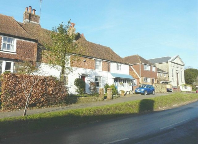
Image: © John Baker Taken: 17 Jan 2012
From left to right: Oriel Cottage. The house is older than it appears from the outside. The visible part dates from the 16th century. The next two houses formed a butcher’s premises – house with shop attached; they date from the 18th century; at one time the butcher was A T Clark. At the far end of the row is the Methodist church, which is dated 1839.
Images are licensed for reuse under creativecommons.org/licenses/by-sa/2.0
Image Location
Latitude
51.154194
Longitude
1.11138