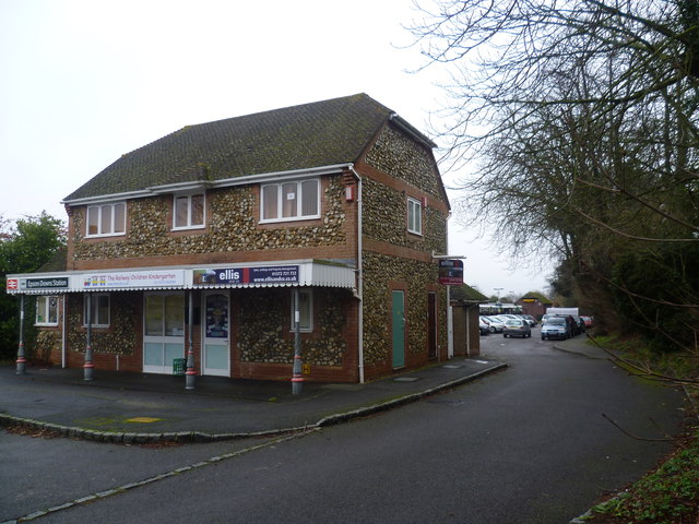
The way in to Epsom Downs station
Introduction
The photograph on this page of The way in to Epsom Downs station by Marathon as part of the Geograph project.
The Geograph project started in 2005 with the aim of publishing, organising and preserving representative images for every square kilometre of Great Britain, Ireland and the Isle of Man.
There are currently over 7.5m images from over 14,400 individuals and you can help contribute to the project by visiting https://www.geograph.org.uk

Image: © Marathon Taken: 18 Jan 2012
Epsom Downs station is just a shadow of what it once was. Opened in 1865, it had nine platform faces, most of which were only used on race days. Tattenham Corner station is more convenient as it is much closer to the racecourse at Epsom Downs and consequently, as race traffic declined, there was no need for all the platforms at Epsom Downs station. Eventually only one island platform remained and then in 1989 the station was demolished to make way for a new housing estate and a new single platform station was built some 300 yards to the north-east. For more information and photographs see http://www.disused-stations.org.uk/e/epsom_downs/index.shtml During the day now there is an hourly service along the single track branch from Sutton. Although the sign on this building says Epsom Downs station, it doesn't seem to be part of the station and you have to go round the back and through the car park to reach the platform.

