Pantyffynnon station
Introduction
The photograph on this page of Pantyffynnon station by Hywel Williams as part of the Geograph project.
The Geograph project started in 2005 with the aim of publishing, organising and preserving representative images for every square kilometre of Great Britain, Ireland and the Isle of Man.

There are currently over 7.5m images from over 14,400 individuals and you can help contribute to the project by visiting https://www.geograph.org.uk
Pantyffynnon station
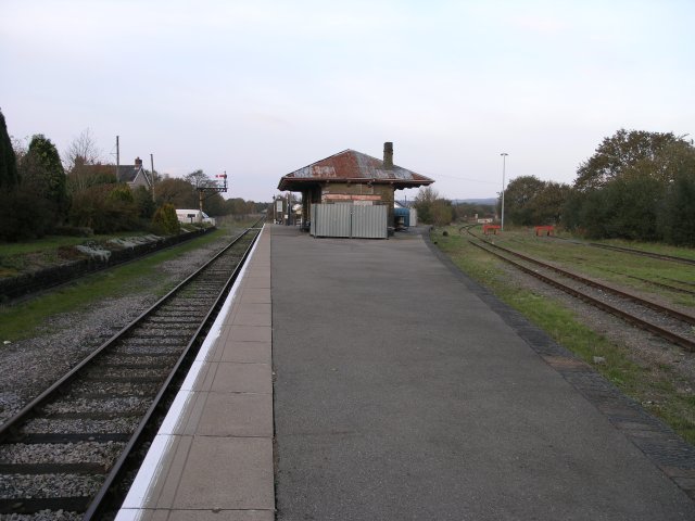
Image: © Hywel Williams Taken: 5 Nov 2006
To the left is the Heart of Wales line and to the right is the "Brynamman Branch" which up until the early '90s, was in use as a mineral line but has recently had £1 million invested in its refurbishment.
Images are licensed for reuse under creativecommons.org/licenses/by-sa/2.0
Image Location
Latitude
51.777953
Longitude
-3.998838