Hardman Square, Manchester
Introduction
The photograph on this page of Hardman Square, Manchester by Stephen Richards as part of the Geograph project.
The Geograph project started in 2005 with the aim of publishing, organising and preserving representative images for every square kilometre of Great Britain, Ireland and the Isle of Man.

There are currently over 7.5m images from over 14,400 individuals and you can help contribute to the project by visiting https://www.geograph.org.uk
Hardman Square, Manchester
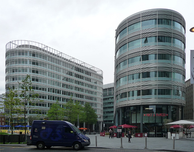
Image: © Stephen Richards Taken: 24 Jun 2011
Part of a large development, 'Spinningfields', begun around 2007, and not yet finished. When the developers, Allied London Properties, encountered choppy financial waters, the scheme was reputedly bailed out by the city council. The two prominent blocks here were designed by Foster & Partners no less. They're the best of a largely mediocre job (perhaps because they seem to hark back a few decades), although to be fair the creation of a public space is not to be sniffed at.
Images are licensed for reuse under creativecommons.org/licenses/by-sa/2.0
Image Location
Latitude
53.479537
Longitude
-2.252047