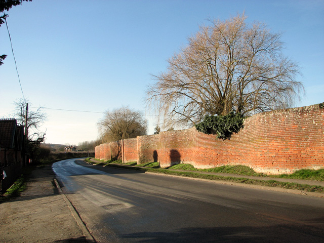
The Street, Easton
Introduction
The photograph on this page of The Street, Easton by Evelyn Simak as part of the Geograph project.
The Geograph project started in 2005 with the aim of publishing, organising and preserving representative images for every square kilometre of Great Britain, Ireland and the Isle of Man.
There are currently over 7.5m images from over 14,400 individuals and you can help contribute to the project by visiting https://www.geograph.org.uk

Image: © Evelyn Simak Taken: 16 Jan 2012
The village is mentioned in the Domesday Book and was linked to the manor of Martley until 1627, when Sir Arthur Wingfield made the 150 acre estate his home. In 1688 Easton was purchased by the Prince of Orange for the Earl of Rochford. The fifth Earl made many improvements before he died in 1830. These included surrounding the Easton Estate and house with its famous crinkle-crankle wall which is believed to be the longest example of this form of wall construction and design. When Easton Hall, the seat of the Duke and Duchess of Hamilton, was demolished and transported to the USA in the 1920s, to be re-assembled as a ranch, the estate's crinkle crankle boundary wall running alongside the road to All Saints Church remained as a fragmentary remnant of the previous estate. The term ‘crinkle crankle' is, in origin, a Suffolk dialect term to describe substantial brick walls which are serpentine, or sinuously curving, in form. Sometimes they are known as ‘ribbon walls'. In their most traditional form they were built as a single line of bricks, with the sinuous design removing the need for buttressing, because the serpentine shape provided its own stability. In the popular mind, crinkle crankle walls are especially associated with Suffolk. http://www.history.org.uk/resources/general_resource_2534_74.html

