Upper Welland
Introduction
The photograph on this page of Upper Welland by Bob Embleton as part of the Geograph project.
The Geograph project started in 2005 with the aim of publishing, organising and preserving representative images for every square kilometre of Great Britain, Ireland and the Isle of Man.

There are currently over 7.5m images from over 14,400 individuals and you can help contribute to the project by visiting https://www.geograph.org.uk
Upper Welland
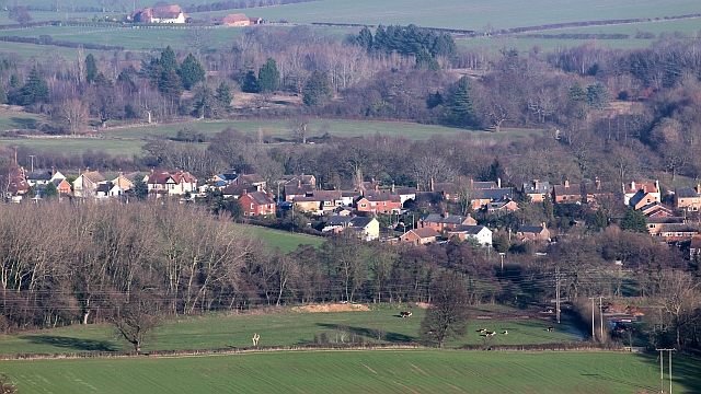
Image: © Bob Embleton Taken: 16 Jan 2012
Viewed from Broad Down on the Malvern Hills. The village has developed from a triangular piece of common land known as Lower Assart before the Welland Inclosure Act of 1851 handed the land over to established land owners of Welland parish. The common land started to have houses with large plots of land built on it. These have continuously been infilled over the last 160 years. The rough land with many evergreen trees is the St Wulstan's Nature Reserve on the site of the hospital built for the expected D-Day casualties in the Second World War. It later became a very successful rehabilitation mental hospital. Shuttlefast Farm is near the top of the picture.
Images are licensed for reuse under creativecommons.org/licenses/by-sa/2.0
Image Location
Latitude
52.065488
Longitude
-2.323795