Paddockhill triangle, Mobberley - the hidden source
Introduction
The photograph on this page of Paddockhill triangle, Mobberley - the hidden source by Peter Turner as part of the Geograph project.
The Geograph project started in 2005 with the aim of publishing, organising and preserving representative images for every square kilometre of Great Britain, Ireland and the Isle of Man.

There are currently over 7.5m images from over 14,400 individuals and you can help contribute to the project by visiting https://www.geograph.org.uk
Paddockhill triangle, Mobberley - the hidden source
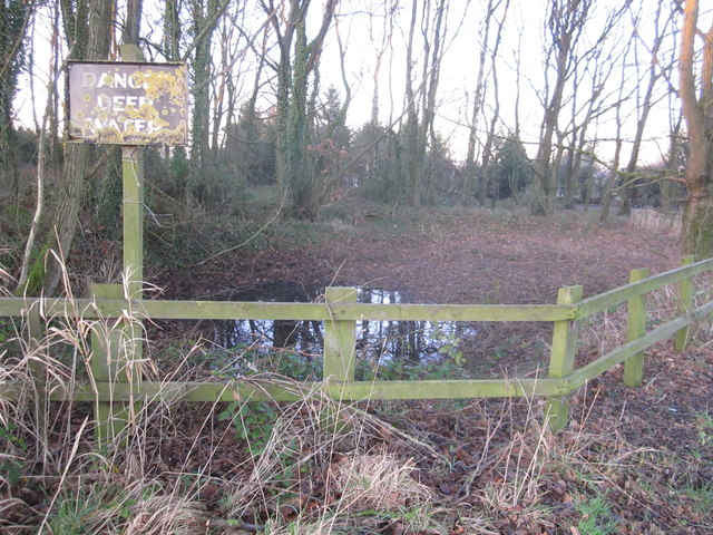
Image: © Peter Turner Taken: 13 Jan 2012
Not deep anymore. The water almost drained away from the (probably natural) mini-mere, even with the winter rains. So a superfluous sign. But probably the reason for the arrangement of the three lanes' confluence.
Images are licensed for reuse under creativecommons.org/licenses/by-sa/2.0
Image Location


Leaflet Map data © OpenStreetMap
Latitude
53.312283
Longitude
-2.281828