Foundation stone, former Salvation Army citadel
Introduction
The photograph on this page of Foundation stone, former Salvation Army citadel by Lairich Rig as part of the Geograph project.
The Geograph project started in 2005 with the aim of publishing, organising and preserving representative images for every square kilometre of Great Britain, Ireland and the Isle of Man.

There are currently over 7.5m images from over 14,400 individuals and you can help contribute to the project by visiting https://www.geograph.org.uk
Foundation stone, former Salvation Army citadel
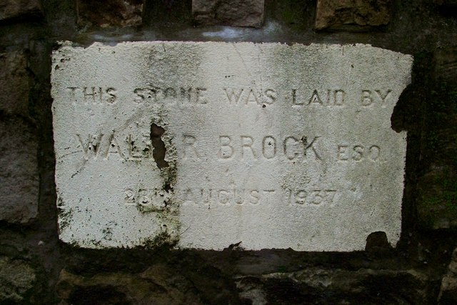
Image: © Lairich Rig Taken: 5 Jan 2012
This is one of three surviving foundation stones visible at the front of Image, which was originally built as a Salvation Army citadel. See that link for further information. The names on the other stones are those of a Miss Whyte and a Major Cockburn, but the inscriptions are otherwise the same. In the photograph whose link is given above, the three foundation stones can be seen as white stones in the darker low boundary wall at the front of the building; the present photograph shows the middle stone.
Images are licensed for reuse under creativecommons.org/licenses/by-sa/2.0
Image Location
Latitude
55.944811
Longitude
-4.573365