Outline of the old St Margaret's church
Introduction
The photograph on this page of Outline of the old St Margaret's church by Stephen Craven as part of the Geograph project.
The Geograph project started in 2005 with the aim of publishing, organising and preserving representative images for every square kilometre of Great Britain, Ireland and the Isle of Man.

There are currently over 7.5m images from over 14,400 individuals and you can help contribute to the project by visiting https://www.geograph.org.uk
Outline of the old St Margaret's church
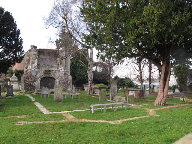
Image: © Stephen Craven Taken: 13 Jan 2012
The outline of the old church as established by archaeology has been marked out in narrow gravel strips. Several burials have taken place within the area since it was demolished in the 19th century.
Images are licensed for reuse under creativecommons.org/licenses/by-sa/2.0
Image Location
Latitude
51.463384
Longitude
-1.6E-5