Mortuary building, St Petroc's Churchyard
Introduction
The photograph on this page of Mortuary building, St Petroc's Churchyard by Adrian Platt as part of the Geograph project.
The Geograph project started in 2005 with the aim of publishing, organising and preserving representative images for every square kilometre of Great Britain, Ireland and the Isle of Man.

There are currently over 7.5m images from over 14,400 individuals and you can help contribute to the project by visiting https://www.geograph.org.uk
Mortuary building, St Petroc's Churchyard
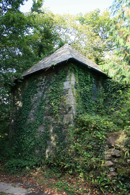
Image: © Adrian Platt Taken: 1 Oct 2008
This small square building with its slate roof is set into a corner of St Petroc's churchyard, and is said to be a mortuary. It is difficult to see as one side is on a steep slope above the Island and it is surrounded by trees.
Images are licensed for reuse under creativecommons.org/licenses/by-sa/2.0
Image Location
Latitude
50.427416
Longitude
-3.837718