Crumlin Road permanently closed ahead
Introduction
The photograph on this page of Crumlin Road permanently closed ahead by Jaggery as part of the Geograph project.
The Geograph project started in 2005 with the aim of publishing, organising and preserving representative images for every square kilometre of Great Britain, Ireland and the Isle of Man.

There are currently over 7.5m images from over 14,400 individuals and you can help contribute to the project by visiting https://www.geograph.org.uk
Crumlin Road permanently closed ahead
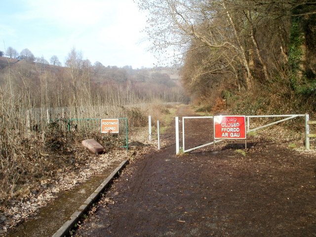
Image: © Jaggery Taken: 17 Feb 2011
About 250 metres north of its junction with the A467 in Crumlin, Crumlin Road has been permanently closed to vehicles. In 2000 the first of several weight restrictions and temporary closures was introduced because the road had begun to fall away. The road, partly in Blaenau Gwent and partly in Caerphilly county borough, was permanently closed to traffic in 2006 after both councils agreed it was the only financially viable option. http://www.geograph.org.uk/photo/2635541 to the other end of the closed section.
Images are licensed for reuse under creativecommons.org/licenses/by-sa/2.0
Image Location
Latitude
51.682411
Longitude
-3.141177