South side of Institute Buildings, Crumlin
Introduction
The photograph on this page of South side of Institute Buildings, Crumlin by Jaggery as part of the Geograph project.
The Geograph project started in 2005 with the aim of publishing, organising and preserving representative images for every square kilometre of Great Britain, Ireland and the Isle of Man.

There are currently over 7.5m images from over 14,400 individuals and you can help contribute to the project by visiting https://www.geograph.org.uk
South side of Institute Buildings, Crumlin
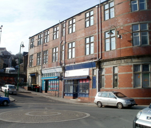
Image: © Jaggery Taken: 17 Feb 2011
Nearest the camera is the office of Age Concern Gwent. Next door is The Village Shop (including Hoppy's Offy). The stone inscription over the doorway at the far end is CRUMLIN NAVIGATION WORKMEN. The building was formerly the institute for miners employed at the nearby Navigation Colliery, which closed in 1967.
Images are licensed for reuse under creativecommons.org/licenses/by-sa/2.0
Image Location
Latitude
51.677916
Longitude
-3.141064