Garshake Reservoir
Introduction
The photograph on this page of Garshake Reservoir by Lairich Rig as part of the Geograph project.
The Geograph project started in 2005 with the aim of publishing, organising and preserving representative images for every square kilometre of Great Britain, Ireland and the Isle of Man.

There are currently over 7.5m images from over 14,400 individuals and you can help contribute to the project by visiting https://www.geograph.org.uk
Garshake Reservoir
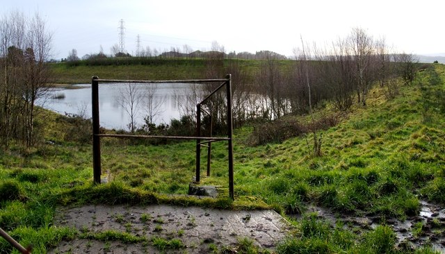
Image: © Lairich Rig Taken: 23 Dec 2011
For further details, see another contributor's earlier photograph: Image For two distant views, one taken when the reservoir was still in use, and the other 21 years later, see Image and Image The present photograph was taken from the northern corner of the fence that surrounds the disused reservoir. As a check on view direction, a small double bump at the centre of the skyline is Dumbowie Hill, its more pointed SE summit behind and just to the left of its more rounded NW one: http://www.geograph.org.uk/snippet/266 In one of his "Streetwise" features in the Lennox Herald newspaper (issue of 28th July 2006), Billy Scobie records that a German sea-mine was discovered embedded in the silt in this reservoir in 1982.
Images are licensed for reuse under creativecommons.org/licenses/by-sa/2.0
Image Location


Leaflet Map data © OpenStreetMap
Latitude
55.95628
Longitude
-4.527345